
SLAM (Simultaneous Localization and Mapping) is a technology that enables robots or other devices to build maps and determine their positions in unknown environments in real time through sensor measurements.SLAM is one of the core technologies for autonomous driving, drone navigation, industrial robots and smart devices. With the development of sensors and algorithms, SLAM technology has evolved into a variety of implementations, including laser SLAM, vision SLAM, ray-vision fusion SLAM, and multi-sensor SLAM.
SLAM Problem Sources
Autonomous navigation technology is a key technology for robots, and robots need to solve the following three problems in order to realize autonomous navigation:
📢: 1. where am I?
📢: 2. Where to go?
📢: 3. How to get there?
The first of these questions is the basis for the last two, and if one doesn’t even know where one is, how can one determine the direction to go? And SLAM is one of the solutions in order to solve the first problem.
In 1887, Smith et al. proposed a method of simultaneous localization and mapping, which opened the prelude to the study of simultaneous localization and map construction.
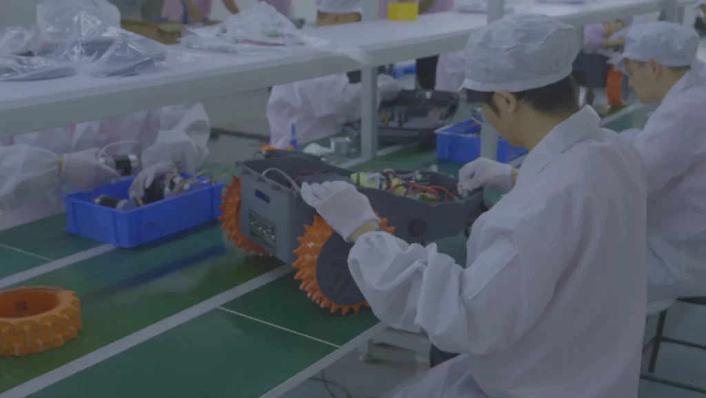
Generally speaking, SLAM systems usually contain multiple sensors and multiple functional modules. According to the core functional modules, the common SLAM systems for robots have two forms: LIDAR-based SLAM (Laser SLAM) and vision-based SLAM (Visual SLAM or VSLAM). We are a robot manufacturer, we provide our customers with robot design, R&D, SMT, and mass production services.
Relationship Between Positioning and Map Building
In the unknown environment to achieve accurate positioning and map building needs accurate maps, the establishment of accurate maps and rely on accurate positioning, forming a kind of mutual coupling, complementary relationship.
1. Lidar SLAM
Laser SLAM is a system that relies on LiDAR (Laser Radar) to generate 3D point cloud data by laser scanning of obstacles, terrain, and objects in the environment for high precision localization and map building. Laser SLAM is widely used in applications such as robotics, driverless cars, and terrain scanners.
📢 : Laser SLAM is decoupled from earlier ranging-based localization methods (e.g., ultrasonic and infrared single-point ranging). The emergence and popularization of LIDAR (Light Detection And Ranging) has led to faster, more accurate, and more informative measurements. The object information collected by LiDAR presents a series of scattered points with accurate angle and distance information, which is called a point cloud. Usually, the laser SLAM system calculates the distance and attitude change of the LiDAR relative to the motion by matching and comparing two pieces of point clouds at different moments, which also accomplishes the localization of the robot itself.
📢: the object information collected by the LiDAR presents a series of dispersed points with accurate angle and distance information, which is called the point cloud. Usually, the laser SLAM system calculates the distance and attitude change of the LIDAR relative to the motion by matching and comparing the two pieces of point clouds at different moments, so as to complete the localization of the robot itself.
📢: the LiDAR distance measurement is more accurate, the error model is simple, the operation is stable in environments other than direct bright light, and the processing of the point cloud is relatively easy. At the same time, the point cloud information itself contains direct geometric relationships, making robot path planning and navigation intuitive. Laser SLAM theoretical research is also relatively mature, and the landing products are more abundant.
Lidar SLAM Advantages
- The emergence and popularization of LiDAR makes the measurement faster, more accurate and more informative.
- The error model is simple and stable in environments other than direct light, and the processing of point clouds is relatively easy.
- The point cloud information itself contains direct geometric relationships, which makes the robot’s path planning and navigation intuitive.
- Mature research, lower threshold in algorithms
Lidar SLAM Disadvantages
- Lack of loopback detection ability, the elimination of cumulative error is more difficult.
- The cost is higher than the visual sensor.
- Not good at localization in dynamic environments.
- Poor multi-robot collaboration.
2. Visual SLAM
Visual SLAM uses a camera as the main sensor to construct a map and achieve localization from the captured image information. With the camera as a low-cost sensor, vision SLAM has become a hot research topic in recent years, and is especially widely used in consumer drones and AR/VR devices.
The use of a camera as the only sensor that senses the environment is known as vision SLAM: it starts from an unknown location in an unknown environment, locates its own position and attitude by repeatedly observing the surrounding environmental features (signposts) while moving, and then incrementally builds a map based on its own position, thus achieving simultaneous localization and map building. A VSLAM system consists of a front-end and a back-end, where the front-end is responsible for responsible for fast localization. The back-end is responsible for slower map maintenance: 1. (Loopback) to return to the original location and correct the position and attitude of each location in between the two visits; 2. Re-localize the robot based on the texture information of the vision when the front-end tracking is lost.
The difficulty of the loopback problem is that a small undetected error occurs at the beginning until the robot goes around the loop once, and the error will accumulate, leading to the problem that the loop cannot be closed.
Visual SLAM Advantage
Visual SLAM uses a camera as the main sensor to construct a map and achieve localization from the captured image information. With the camera as a low-cost sensor, vision SLAM has become a hot research topic in recent years, and is especially widely used in consumer drones and AR/VR devices.
The use of a camera as the only sensor that senses the environment is known as vision SLAM: it starts from an unknown location in an unknown environment, locates its own position and attitude by repeatedly observing the surrounding environmental features (signposts) while moving, and then incrementally builds a map based on its own position, thus achieving simultaneous localization and map building. A VSLAM system consists of a front-end and a back-end, where the front-end is responsible for responsible for fast localization. The back-end is responsible for slower map maintenance: 1. (Loopback) to return to the original location and correct the position and attitude of each location in between the two visits; 2. Re-localize the robot based on the texture information of the vision when the front-end tracking is lost.
The difficulty of the loopback problem is that a small undetected error occurs at the beginning until the robot goes around the loop once, and the error will accumulate, leading to the problem that the loop cannot be closed.
Visual SLAM Disadvantage
- More affected by light.
- performs poorly in untextured environments (e.g. facing a neat white wall).
- the algorithmic threshold of the technology is also much higher than that of laser SLAM. map construction based on nonlinear optimization is a very complex and time-consuming computational problem.
3. Convergence of Lidar SLAM and Visual SLAM
Ray-vision fusion SLAM achieves more robust localization and map construction by fusing data from LIDAR and cameras, combining the accuracy of lasers with the rich visual information of cameras. This fusion improves performance in complex environments and has been widely used especially in the field of autonomous driving.
Advantages and Disadvantages
- Performance enhancement: Combining the high precision of laser with the rich information of vision makes the system perform more stably in environments such as light and dynamic obstacles.
- High computation: Due to the integration of multiple data sources, the computational complexity of real-time processing is high.
4. Multi-Sensor SLAM
Multi-sensor SLAM combines data from multiple sensors (IMUs, cameras, LIDAR, etc.) to achieve high-precision localization and map building by fusing information from different sources. Multi-sensor SLAM has become an important technology for robot navigation and unmanned driving due to its robustness and wide adaptability.
SLAM (Simultaneous Localization and Mapping) system is a technology that enables robots to simultaneously perform autonomous localization and environment map construction by combining sensor measurement data. Realistic laser and vision SLAM systems are almost always equipped with auxiliary localization tools such as inertial elements, turbine odometers, satellite positioning systems, and indoor base station positioning systems.
SLAM systems are usually fused based on the following sensors:
Inertial Measurement Unit (IMU): the IMU is able to provide acceleration and angular velocity measurements of the robot, which are used to estimate the robot’s attitude and position changes. Compared to other sensors, IMUs have the ability to measure at high frequencies, but can suffer from problems such as drift.
Vision sensors: these include cameras, depth cameras, etc. By extracting and tracking features in the environment, the position and map information of the robot in the environment can be obtained by using vision sensors. Vision sensors can provide rich perceptual information, but are sensitive to problems such as light and occlusion.
LiDAR: LiDAR obtains geometric information about the environment by emitting a laser beam and measuring the light reflected back. LIDAR provides highly accurate distance and position measurements and can be used for map building and obstacle detection. However, LIDAR is typically more expensive, larger, and may have limitations for particularly bright or dark objects.
Range sensors: such as ultrasonic sensors and infrared sensors are used to measure the distance between the robot and surrounding objects. Range sensors are commonly used for close-range obstacle avoidance and environment modeling, but have limited accuracy and range.
Fusion of data from different sensors can combine the advantages of various sensors to improve the accuracy and robustness of localization and map building. Commonly used methods include Extended Kalman Filter (EKF), Particle Filter, and optimization methods (e.g., graph optimization). These methods are able to fuse the information obtained from different sensors and perform state estimation and map construction to realize the functions of SLAM systems.
Advantage and Disadvantage
- Adaptable: multi-sensor SLAM is able to combine and use multiple sensors according to different environments to achieve more accurate and robust localization.
- Redundant information: multi-sensor fusion can improve the fault tolerance of the system and enhance the robustness of the system.
- Complexity: multi-sensor fusion requires data calibration and synchronization of different types of sensors, which increases the complexity of system design.
The Future of SLAM
Algorithm efficiency and real-time
With the widespread use of SLAM in autonomous driving, UAVs and consumer electronics devices, the real-time and computational efficiency of SLAM algorithms has become a research priority. To cope with the complexity of multi-sensor fusion and the huge computational volume of data processing, future SLAM algorithms will need to rely more on hardware acceleration (e.g., GPUs, FPGAs) and distributed computing.
Robustness and Environmental Adaptation
The robustness of SLAM technology in complex dynamic environments, such as city streets, indoor and outdoor transition scenes, etc., needs to be further improved. In the future, SLAM algorithms will pay more attention to the robustness in response to dynamic obstacles, illumination changes, and texture-free environments to enhance the adaptability of the system.
Semantic SLAM
While traditional SLAM mainly focuses on the construction of geometric information, future SLAM will gradually integrate semantic understanding, i.e., in the process of map construction, the system can not only construct geometric maps, but also recognize the semantic information in the map (e.g., buildings, road signs, vehicles, etc.). This will greatly enhance the application value of SLAM in autonomous driving and service robotics.
Multimodal Sensor Fusion
With the development of sensor technology, future SLAM systems will rely more on the fusion of multimodal sensors (laser, vision, radar, ultrasonic, IMU, etc.) to realize all-round, multi-dimensional data sensing, thus further improving the accuracy and robustness of SLAM systems.
Lightweight and Low Power Consumption
For embedded systems and consumer-grade devices (e.g., AR/VR, UAVs), SLAM technology needs to achieve efficient operation with limited computing resources. Future SLAM algorithms will pay more attention to lightweight and low-power design to adapt to the needs of embedded hardware platforms.
Industries Covered
SLAM technology has been widely used in several industries, including but not limited to:
Autonomous driving: By fusing LIDAR, vision and IMU, SLAM technology enables autonomous vehicles to achieve high-precision positioning and navigation in complex urban environments.
Robot navigation: Industrial and service robots rely on SLAM technology to accomplish autonomous navigation and task execution in unknown environments. such as Altverse visual robot lawn mower is used the camera to navigation and mapping.
Drones: SLAM technology plays an important role in autonomous flight and navigation of drones, especially in environments where GPS signals are weak or ineffective.
AR/VR: Augmented reality and virtual reality devices need SLAM technology to realize real-time environment perception and virtual scene overlay.
Summarize
SLAM technology is the core technology in today’s intelligent devices such as autonomous driving, robotics, and drones. With the advancement of sensors and the development of algorithms, laser SLAM, vision SLAM, ray-vision fusion SLAM, and multi-sensor fusion SLAM have shown their unique advantages in different scenarios. In the future, SLAM technology will develop towards higher accuracy, real-time, robustness, and multimodal fusion, providing more reliable and efficient solutions for various industries.
Want to Custom Mobile Robot and Robot Mower, Contact US
Turn Your Robotic Mower Vision Into Production
Custom OEM/ODM manufacturing — PCBA, assembly, and logistics from one partner.
- Fast turnaround from design to delivery
- Trusted by brands across the globe
- Free DFM review before you commit
- Dedicated engineer within 24 hours

Expert in robotics, passionate about exploring a wide range of robots, robots that make work more efficient, exploring robots, including mobile robots, lawnmower robots.


